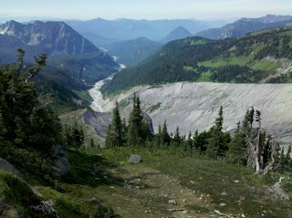
where: mt rainier national park
who drove: dave ross drove his prius from mercer island, i drove back to mercer island.
participants: myself
food: just water
trail: 2.2 miles of paved walk, stone, gravel, 2x snowfields and occasional dry dirt.
views/weather: you can see mt rainer and the cascades i guess. i don't really know this area. it was beautiful. you could see the niqually glacier and the giant canyon it has carved in mt. rainier. i think i saw mt st. helens. and something called like "jagged teeth" or "goats points," idk. you could really see in all directiosn except directly north because of the trails orientation to rainier which blocks the entire horizon. no clouds around rainier and just some haze around the surrounding ranges. the temperature, from memory, was 70 degrees.
notes: beyond pebble creek it becomes just snow field. signs recommend you don't go beyond pebble creek unless you have ropes and axes and crampons. the people on the trail: there are like lots of tourists, inexperienced hikers, young kids messing around in the snow, leaving water bottles on the ground. everyone had a camera. other people were collected in hiking parties and each carrying heavy backpacks. they seemed to be headed for camp muir which was a mile beyond pebble creek. from camp muir the typical plan is to leave at 2am the next day for the summit of rainier.

No comments:
Post a Comment